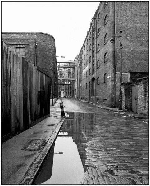
Wapping High Street, Gun Wharves.
London's East End
Wapping High Street including King Henry's Wharves & Gun Wharves, London
HISTORY:
Wapping developed along the northern embankment of the Thames, hemmed in by the river to the south and what was Wapping Marsh to the north, creating a peculiarly narrow and constricted shape, consisting of the axis of Wapping High Street and some north-south side streets. The building of the London Docks to the north and west of the High Street in the 1805 transformed the area from residential to docklands and the population declined as houses were destroyed to build giant warehouses along the riverfront. The site now occupied by Gun Wharves, originally known as Wheatsheaf Wharf, had a warehouse building on it from at least the 1870s. In the 1890s it was called Sharpe's Wharf and in the early C20 it was a paper wharf. A company called Litchfield and Soundry appear to have redeveloped the site in the late 1920s as Gun Wharves. In the 1980s the London Docks were largely filled in and redeveloped with a variety of commercial, light industrial and residential properties. Gun Wharves was converted to residential use at this time.
Gun Wharves has special architectural interest as a handsome Thames riverside warehouse of the late 1920s, built with a giant arcade marking the divisions of the loading and window bays. The warehouses close the vista of Wapping High Street as the footprint of the building traces the curve of the street. Along with Warehouses E, F and G and King Henry's Wharves, with which Gun Wharves has group value, the ensemble creates one of the few 'cavernous' streets remaining in Docklands.